Slide 1 of 3
Shrimp or Rice? The Struggle Over Salinity in Coastal Bangladesh

Whenever we discuss Bangladesh’s coastal areas in relation to climate change, salinity is almost always a talking point. This is especially true for the southwest where saline intrusion has steadily increased due to environmental pressures, such as rising sea levels, cyclones, tidal flooding, and declining freshwater availability. In turn, these changes have affected the lives of many people who depend on coastal resources for their survival.
That being said, my recent visit to these areas suggested a far more nuanced story. We visited 18 villages across Khulna, Satkhira, and Bagerhat, where it became clear that climate change was not the sole factor determining how communities experienced salinity. The way local communities manage land and water resources directly influences whether salinity becomes a permanent blight or a recoverable challenge.
Over the last few decades, coastal Bangladesh has undergone major economic and environmental changes. Shrimp farming has expanded significantly and has become an important source of income, employment, and export revenue. At the same time, agriculture, particularly rice cultivation, remains central to rural livelihoods.
The challenge is that shrimp farming and crop cultivation depend on different water conditions. Rice production requires freshwater, while shrimp aquaculture generally requires saline or brackish water. Both activities are important, but managing them within the same landscape introduces difficult choices. When saline water spreads into agricultural fields, rice production becomes untenable, gradually forcing land conversion toward shrimp farming.
What is often overlooked is that salinity does not affect all places in the same way. My observation revealed several examples where nearby areas faced similar climatic conditions but experienced completely different outcomes due to differences in land-use decisions and water management practices.
A striking example is Mariala village in Assasuni, Satkhira. Local residents explained that after Cyclone Amphan in 2020, a sluice gate was closed, blocking saline water from entering one side of the village's main road. Over time, soil health recovered, allowing farmers to return to annual rice cultivation. Although inadequate drainage still causes seasonal waterlogging, this experience suggests that saline degradation may not always be permanent. With proper water management, damaged agricultural land can regain productivity.
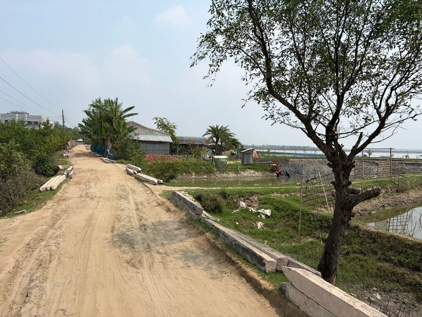
Directly across the same road, however, agricultural recovery was quite limited due to maintaining saline water for shrimp cultivation. Both sides experienced the same cyclone, rainfall patterns, and environmental conditions, but the key differences were in the management of land and water resources.
This contrast persisted in Dashalia Village (Koyra, Khulna) and Hurka Village (Rampal, Bagerhat). In both sites, one side of the main road was dominated by shrimp farming and could not support rice farming, while the other side continued to support it. These examples do not excuse climate change for increasing salinity, but they show how environmental outcomes are also shaped by human decisions.
This distinction is vital for future adaptation planning. Many adaptation interventions have focused heavily on infrastructure and technological measures such as: embankments, sluice gates, desalination units, and rainwater harvesting. But these alone cannot resolve the fundamental struggle between competing demands for fresh and saline water. Without coordinated planning, conflicts between different groups may escalate, and adaptation efforts may fail to provide long-term solutions. This is precisely why land-use planning should become a central part of coastal adaptation strategies.
For many years, coastal landscapes have developed through a combination of market demands, individual decisions, and local power relations, resulting in shrimp farms, agricultural fields, settlements, and water infrastructure often existing together without proper coordination. This fragmented approach allows one group’s decisions to directly affect another group’s livelihood. Wealthy shrimp-farm owners often use their influence to open sluice gates and dig canals to bring saline water into their farms (ghers) from the nearby river, which deliberately floods nearby agricultural land with saltwater.
Protecting these vulnerable farmers requires an equitable and participatory system. Coastal land-use policies must identify suitable areas for shrimp cultivation while protecting agricultural zones from unnecessary saline intrusion. Water infrastructure, including canals and sluice gates, must be governed according to broader land-use priorities rather than being controlled by the interests of the most influential groups. And most importantly, local communities must be involved in these decisions. Participatory planning can create more practical, equitable, and sustainable solutions by bringing farmers, shrimp cultivators, and local officials together in shared platforms to collectively map out protected agricultural zones and manage water infrastructure fairly.
Salinity in coastal Bangladesh is not merely a natural consequence of a changing climate; it is an active outcome of water control, land use, and local governance. As Bangladesh invests heavily in climate resilience, policymakers must look beyond engineering solutions alone. The future of the coastal region will depend not just on how we respond to sea levels, but on how effectively we plan, manage, and share our land and water.
Md Ayatullah Khan is a doctoral researcher in the Department of Geography at Hong Kong Baptist University. His research focuses on climate change vulnerability assessment, sustainable water management, and community-led adaptation strategies.